Schematics
What is a schematic?
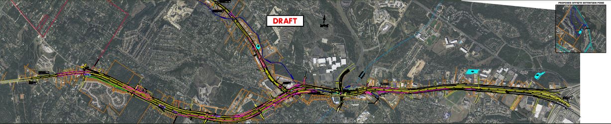
A schematic is the preliminary roadway design laid out on an aerial map of the project area. It shows a blueprint of the roadway TxDOT will build and includes where each element will be placed (e.g., a travel lane and a ramp).
Date of Current Schematic: December 2021
Download Current Schematic Design
Recent update due to design changes: Design changes occurred to provide better operations for safety and mobility in the corridor, or as a result of utility conflicts. These adjustments to the design included adding two new bypass lanes for improved non-signalized mobility west of the “Y”, tweaking the shared-use path route through the “Y” interchange, and making operational improvements that enhance safety and mobility for the traveling public. Learn more here.
We understand that, for some, reviewing these maps without a project team member can be challenging. You are always welcome to contact us online or call us at (512) 342-3281 to help navigate these maps.
There is a possibility that TxDOT or CRC will suggest a change in the roadway design due to any number of factors, including but not limited to minimizing utility conflicts and schematic refinements. Should this occur, we will engage and inform impacted property owners and stakeholders about those changes.